Weather satellites have transformed forecasting from regional guesswork into a global science. Two broad families of weather satellites work together: geostationary satellites that watch huge areas continuously, and polar-orbiters that scan the entire Earth twice a day at higher resolution.
Geostationary weather imagery
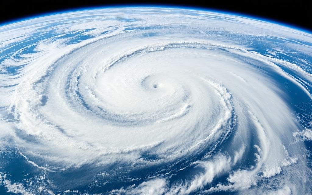
Full-disk GeoColor from NOAA's GOES-East and GOES-West satellites at 35,786 km. Updates every ~10 minutes.


Geostationary Satellites
At 35,786 km altitude over the equator, geostationary satellites match Earth's rotation and appear to hover above one spot. Examples include the U.S. GOES series, Europe's Meteosat, Japan's Himawari and China's Fengyun-4. They produce a fresh image of their hemisphere every few minutes — perfect for tracking fast-evolving systems like hurricanes and severe thunderstorms.
Polar-Orbiting Satellites
Satellites like NOAA-19, NOAA-20, NOAA-21 (JPSS) and Europe's MetOp orbit pole-to-pole at ~830 km altitude. As Earth rotates beneath them, they image the entire planet twice every 24 hours at much higher detail than GEO can provide. They carry microwave sounders that can see through clouds to measure temperature and moisture profiles.
Imagery Channels
- Visible — daylight cloud and surface imaging.
- Infrared — works at night; cold high cloud tops appear bright, indicating thunderstorms.
- Water vapor — tracks mid-tropospheric moisture even in cloud-free regions.
- Microwave — penetrates cloud to measure precipitation and temperature.
How Forecasts Use Satellite Data
Numerical weather prediction (NWP) models ingest satellite radiances continuously and adjust the atmospheric "state" used to launch each forecast cycle. A modern global model assimilates millions of satellite observations every six hours. Without weather satellites, the famous five-day forecast skill we enjoy today simply wouldn't exist.
Watch Storms Live
Track NOAA polar satellites on the live tracker, or see imagery examples in our Earth Observation Center.