


How Earth Observation Works
Earth observation satellites carry instruments that measure either reflected sunlight (passive imaging) or echoes from their own emitted signals (active radar and lidar). Each pixel they record is tagged with a precise location and timestamp, then processed on the ground to produce maps, change-detection products, and analytic insights. Read the full Earth Observation guide for instrument types and resolution classes.
Wildfire Imagery
Sensors like VIIRS aboard NOAA-20 and Suomi-NPP detect hot pixels in the shortwave infrared even through smoke. NASA's FIRMS service publishes near-real-time fire detections worldwide, used by emergency managers across the western U.S., Australia, the Mediterranean and Siberia.
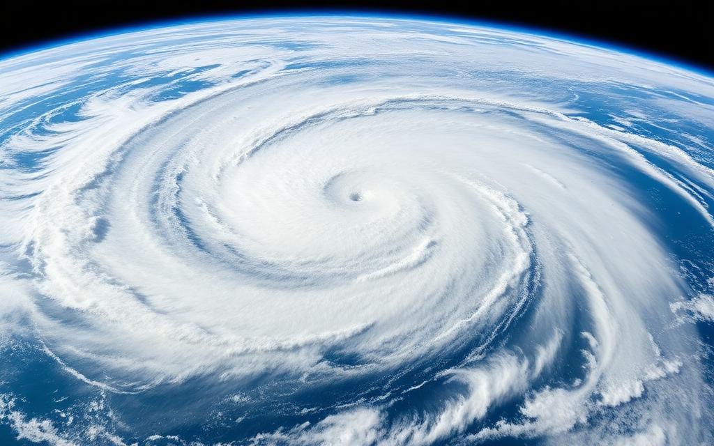
Weather Systems
GOES-16 and GOES-18 deliver new full-disk images every 10 minutes (and mesoscale sectors every 60 seconds) — fast enough to watch convective cells erupt and track hurricane eyewall replacement cycles in real time.
Cloud Maps
Cloud-top temperatures from infrared channels reveal storm intensity. Microwave sounders can see through non-precipitating cloud to map atmospheric moisture profiles — critical input for numerical weather models.
From Imagery to Action
EO data underpins agriculture (NDVI vegetation health), shipping (sea-ice maps), insurance (post-disaster damage), defense (change detection) and finance (oil-tank inventories from shadow lengths). It is one of the fastest-growing sectors of space.