Live Satellite Tracker
Watch satellites move across Earth in real time. Click any satellite to see its current latitude, longitude and altitude.
- Latitude
- 0.00°
- Longitude
- -180.00°
- Altitude
- 408 km
- Velocity
- ~7.62 km/s
Live imagery gallery
Real images streaming down from active satellites right now — full-disk Earth views, weather feeds and the ISS.
Latest full-disk Earth from DSCOVR
Captured ~1.5 million km from Earth at the Sun-Earth L1 Lagrange point. Refreshed daily by NASA.
Geostationary weather imagery
Full-disk GeoColor from NOAA's GOES-East and GOES-West satellites at 35,786 km. Updates every ~10 minutes.


ISS live HD stream
Live video feed from cameras aboard the International Space Station, courtesy of NASA. When a black screen is shown, the ISS is on the night side of Earth or a signal switch is in progress.

NASA Live: Official Stream
24/7 NASA TV Public Channel — launches, mission briefings, spacewalks and Earth views from orbit. Streamed directly from NASA's Akamai CDN (no YouTube).
Spacewalks & ISS operations
Real footage of astronauts working outside the International Space Station.
Rocket launches
Liftoffs from NASA missions — Saturn V to SLS, Falcon to Atlas.
Satellite deployments
Spacecraft separating from rockets and beginning their orbital missions.
Hubble Space Telescope
Servicing missions, deployments and imagery from Hubble.
James Webb Space Telescope
Launch, deployment and science from JWST.
Earth from satellites
Our planet as seen from orbiting spacecraft.
Weather satellites
GOES and NOAA Earth-observing weather spacecraft in action.
Landsat Earth observation
Decades of Earth imaging from the Landsat program.
Mars rovers & orbiters
Footage from missions exploring the Red Planet.
Voyager & deep space
Iconic deep-space probes still phoning home.
Dragon cargo & crew
SpaceX Dragon launches, dockings and returns.
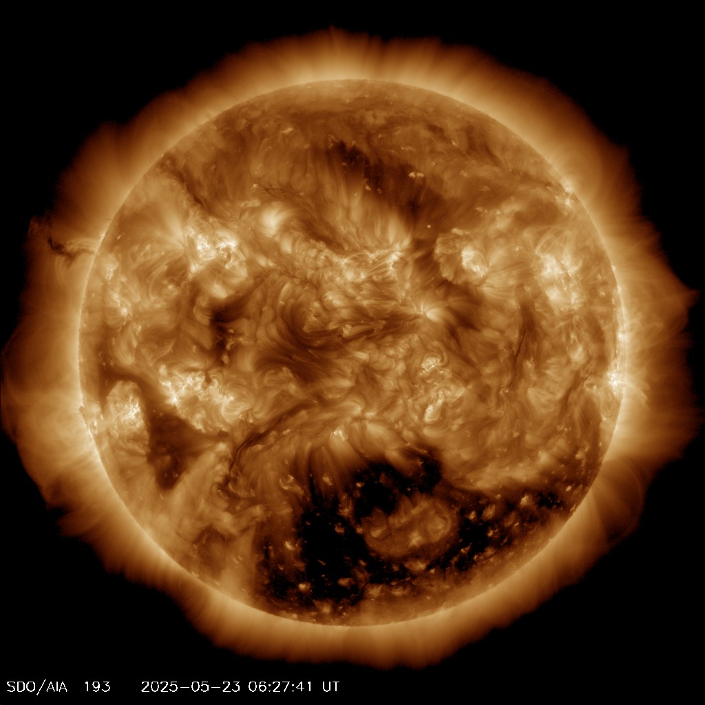
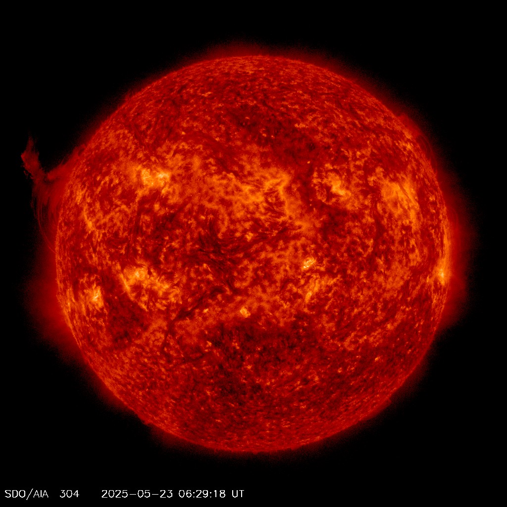
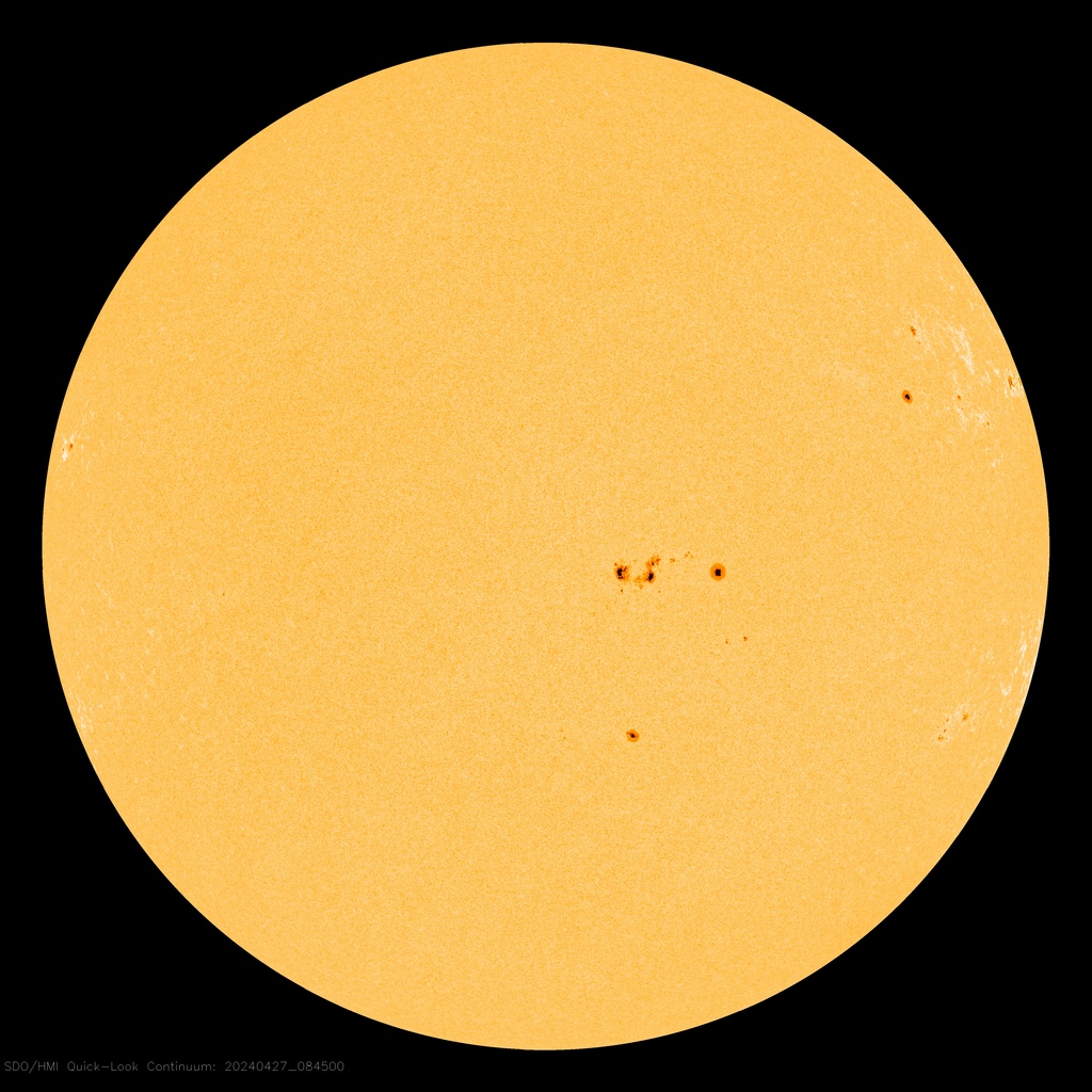
The Sun right now
Latest images from the Solar Dynamics Observatory, watching our star across multiple wavelengths every few seconds.

Astronomy Picture of the Day
A new image or video of our universe, hand-picked by NASA astronomers every day since 1995.
Latest from Curiosity rover
The most recent raw images beamed back from NASA's Curiosity rover on the surface of Mars.
Global true-color mosaic
Cloud-and-land snapshot from VIIRS aboard Suomi-NPP, composited from yesterday's polar-orbit passes.
From the Hubble & Webb archives
Curated deep-space imagery returned from the Hubble and James Webb space telescopes.
How the Tracker Works
Every object in this map is one of more than 8,000 active satellites currently orbiting Earth. Their positions are derived from Two-Line Element (TLE) sets — short numerical descriptions of an orbit published by space surveillance networks. Combined with simple physics (Kepler's laws of planetary motion), TLEs let us project where any satellite will be at any moment.
Low-Earth-orbit satellites such as the International Space Station or a Starlink spacecraft circle the planet roughly every 90 minutes at altitudes between 400 km and 600 km. GPS satellites sit much higher — about 20,200 km — and complete one orbit every 12 hours. Geostationary weather satellites stay fixed above one spot on the equator at 35,786 km.
What You're Seeing
- Dots represent the current ground-track position of each satellite.
- Dashed arcs trace the projected ground path the satellite will sweep next.
- Colors indicate satellite category: crewed, comms constellation, navigation, weather.
Why Track Satellites?
Satellite tracking is more than a curiosity. Amateur radio operators use it to time contacts with the ISS. Photographers chase Starlink "trains" right after launch. Astronomers plan observations to avoid satellite glints. And anyone using a phone's GPS, watching weather radar, or streaming a TV broadcast is depending — directly or indirectly — on the spacecraft shown above.
Featured Satellites
- ISS (ZARYA) — humanity's continuously crewed laboratory.
- Starlink — SpaceX's broadband mega-constellation.
- GPS Block IIF — the backbone of global navigation.
- NOAA-19 — polar-orbiting weather imager.
Want to learn more?
Read our beginner guide to orbital mechanics, or explore satellite coverage maps to see where each system can actually serve users on the ground.