Before satellites, hurricanes routinely surprised coastlines. The 1900 Galveston storm killed 6,000 people partly because forecasters had no way to see it form. Today, every hurricane is tracked continuously from the moment it organizes off the African coast.
Two Orbits, One Forecast
Modern weather forecasting depends on two complementary fleets: geostationary satellites for fast-cadence imagery and polar-orbiters for global coverage and atmospheric soundings.
Multiple Eyes, Multiple Channels
GOES-R class satellites image in 16 spectral channels — visible, near-infrared, water vapor, longwave infrared. Each channel reveals something different, from low-cloud fog to deep convection in storm anvils.
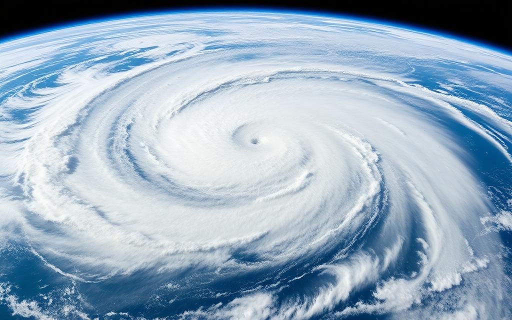
Hurricane Tracking
One-minute mesoscale imagery from GOES lets meteorologists detect eyewall replacement cycles and rapid intensification — the difference between Category 3 and Category 5 landfall.
Read more in our Earth Observation guide.